Accelerating resiliency planning in communities across the Commonwealth

Search

Climate Mapping for Resilience and Adaptation

Home » Community Action » Climate Mapping for Resilience and Adaptation

Climate Mapping for Resilience and Adaptation

Home » Community Action » Climate Mapping for Resilience and Adaptation

Climate Mapping for Resilience and Adaptation (CMRA)
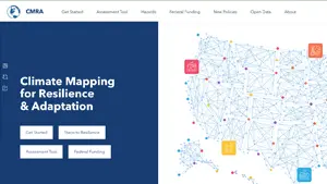
The U.S. Climate Resilience Toolkit offers a framework to help communities systematically consider and address their climate hazards. Communities can use this portal to document their past, present, and future exposure to climate-related hazards.

Data and maps available in this tool are downscaled results from global climate models. Results for selected geographies indicate how local exposurfe to five common climate-related hazards is projected to change through this century. Assessing climate vulnerability and risk to your local assets will require additional information that is not available in this tool.

Climate hazard projection topics include

  • Extreme Heat
  • Drought
  • Wildfire
  • Flooding
  • Coastal Inundation

Check how conditions related to common climate hazards are projected to change over the next several decades. Results can help you understand if people, property, and infrastructure could be exposed to climate-related hazards.

Click here to view the resource.


Become a Member
Become a Sponsor
Become a Volunteer

Sign Up for E-News

Get news and notifications from Resilient Virginia.

The Resilience Calendar

  • Supporting State & Subnational Decision-Making in the Electricity System
    Date: April 1, 2025
    Location: Virtual

    The U.S. electricity system is operated by a number of different decision-makers (utilities, public utility commissions, independent system operators), with varying goals, capacities, and constraints. Nationally-focused entities including the Department of Energy, FERC,…

  • Leveraging Geospatial Tools for Effective Environmental Planning: A Hurricane Helene Case Study
    Date: April 2, 2025
    Location: Virtual

    This webinar will include topics that incorporate geospatial tools in their research to investigate distinct environmental aspects linked to extreme climate events such as Hurricane Helene. The speakers will demonstrate how these tools can…

  • Clean Transportation Rally in Richmond
    Date: April 3, 2025
    Location: 1500 E Main St, Richmond, VA 23219, USA

    Virginia Clean Cities (VCC) honors Virginia's green fleets and stakeholders with this special event held at the Main Street Station in Richmond. VCC will also host a reception, awards ceremony, workshops and vehicle demos.…

  • Mid-Atlantic Farmer Forum: Updates, Insights & Conversations on Farm Policy and Funding
    Date: April 3, 2025
    Location: Virtual

    Federal farm policy and funding has been changing rapidly. If you are a farmer or work in agriculture, you may have a lot of concerns. Join us for a forum with fellow farmers to…

Latest News & Resources

Resilient Virginia News: Winter 2025

Meet Jessica Steelman, Resilient Virginia’s Executive Director … Resilient Virginia Events … Program and Project Updates … Board of Directors Updates … Community Flood Preparedness Fund Grants … VDEM Announces Application Period for BRIC and FMA Grants … GHHI’s Thriving Communities Grantmaking Program … Climate Smart Communities Initiative … more.

Read More »

Climate Change and Displacement in U.S. Communities

EcoAdapt conducted a survey with the Strong, Prosperous, and Resilient Communities Challenge to determine if and how people working to address displacement pressures are considering the effects of climate change. This survey is part of a broader project in collaboration with the Urban Displacement Project to better understand the intersections between climate change and displacement pressures.

Read More »