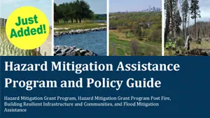
Accelerating resiliency planning in communities across the Commonwealth

Search

Trish Porter

NOAA Sea Level Rise Viewer

NOAA Sea Level Rise Viewer

The purpose of the NOAA Sea Level Rise Viewer is to provide federal, state, and local coastal resource managers and planners with a preliminary look at sea level rise and coastal flooding impacts.

Read More »
NOAA Climate at a Glance

NOAA Climate at a Glance

Climate at a Glance was developed at the request of NOAA Headquarters for near real-time analysis of monthly temperature and precipitation data across the contiguous U.S. and intended for the study of climate variability.

Read More »
NOAA Sea Level Rise Viewer

NOAA Sea Level Rise Viewer

The purpose of the NOAA Sea Level Rise Viewer is to provide federal, state, and local coastal resource managers and planners with a preliminary look at sea level rise and coastal flooding impacts.

Read More »
NOAA Climate at a Glance

NOAA Climate at a Glance

Climate at a Glance was developed at the request of NOAA Headquarters for near real-time analysis of monthly temperature and precipitation data across the contiguous U.S. and intended for the study of climate variability.

Read More »
There are no more posts to display.

Sign Up for E-News

Get news and notifications from Resilient Virginia.

The Resilience Calendar

  • Roots & Rhythms: A Celebration of Black Farmers and Food Traditions
    Date: June 7, 2025
    Location: 3025 Frontier Rd NW, Roanoke, VA 24012, USA

    This event will be an evening of honoring the legacy of Black farmers and food traditions in the Roanoke region and beyond. This special event brings together food, film, and conversation to celebrate the…

  • RVCA Priority-Setting Workshop
    Date: June 10, 2025
    Location: Virtual

    Resilient Virginia's Priority-Setting  Workshops will bring together cross-sector folks from across central and southwest Virginia to discuss the region's goals and priorities in greater depth.

    Learn more and register

  • VA DEQ's Efforts to Protect and Restore the Chesapeake Bay
    Date: June 10, 2025
    Location: Virtual

    The Chesapeake Bay, the largest estuary in the U.S., is home to diverse plant and animal life but faces water quality challenges. Its watershed spans six states and D.C., making its preservation…

  • Evolving Geodigital Data: Opportunities, Challenges & Disruptions
    Date: June 11, 2025
    Location: Virtual

    The Geographical and Geospatial Sciences Committee (GGSC) is hosting a meeting on June 11th, 2025 on Evolving Geodigital Data. This meeting will explore what constitutes authoritative geospatial data and how it relates to geospatial data…

Latest News & Resources