Accelerating resiliency planning in communities across the Commonwealth

Search

National Risk Index

Home » Community Action » National Risk Index

National Risk Index

Home » Community Action » National Risk Index

FEMA National Risk Index
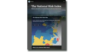
The National Risk Index is a dataset and online tool to help illustrate the United States communities most at risk for 18 natural hazards. It was designed and built by FEMA in close collaboration with various stakeholders and partners in academia; local, state and federal government; and private industry.

    The Risk Index leverages available source data for natural hazard and community risk factors to develop a baseline risk measurement for each United States county and Census tract.

    The National Risk Index’s interactive mapping and data-based interface enables users to visually explore individual datasets to better understand what is driving a community’s natural hazard risk with minimal technical expertise. Users may also create reports to capture risk details on a community or conduct community-based risk comparisons, as well as export data for analysis using other software.

    Click here to view the resource.

    Become a Member
    Become a Sponsor
    Become a Volunteer

    Sign Up for E-News

    Get news and notifications from Resilient Virginia.

    The Resilience Calendar

    • Roots & Rhythms: A Celebration of Black Farmers and Food Traditions
      Date: June 7, 2025
      Location: 3025 Frontier Rd NW, Roanoke, VA 24012, USA

      This event will be an evening of honoring the legacy of Black farmers and food traditions in the Roanoke region and beyond. This special event brings together food, film, and conversation to celebrate the…

    • RVCA Priority-Setting Workshop
      Date: June 10, 2025
      Location: Virtual

      Resilient Virginia's Priority-Setting  Workshops will bring together cross-sector folks from across central and southwest Virginia to discuss the region's goals and priorities in greater depth.

      Learn more and register

    • VA DEQ's Efforts to Protect and Restore the Chesapeake Bay
      Date: June 10, 2025
      Location: Virtual

      The Chesapeake Bay, the largest estuary in the U.S., is home to diverse plant and animal life but faces water quality challenges. Its watershed spans six states and D.C., making its preservation…

    • Evolving Geodigital Data: Opportunities, Challenges & Disruptions
      Date: June 11, 2025
      Location: Virtual

      The Geographical and Geospatial Sciences Committee (GGSC) is hosting a meeting on June 11th, 2025 on Evolving Geodigital Data. This meeting will explore what constitutes authoritative geospatial data and how it relates to geospatial data…

    Latest News & Resources