by Rear Admiral Ann C. Phillips, US Navy (Retired)
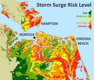
The Hampton Roads Sea Level Rise Preparedness and Resilience Intergovernmental Pilot Project (IPP) (convened by Old Dominion University and launched in June 2014) was one of four National Security Council pilots and three Department of Defense pilots established to prepare the United States for the impacts of a changing climate.
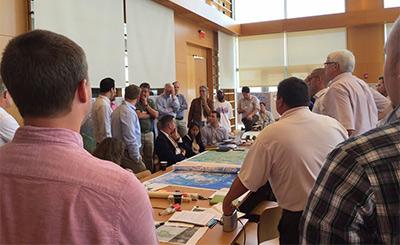
Hampton Roads localities (including Norfolk, Hampton, Newport News, Portsmouth, and Virginia Beach), four Cabinet Departments of Virginia Governor Terry McAuliffe, 11 Federal Agencies (including DOD, Army, Navy, and Air Force), DHS (U.S. Coast Guard), DOT, DOE, Port of Virginia, VDOT, HRPDC, HRTPO, HRSD, and a variety of private businesses and non-profits worked together over two years to develop recommendations and strategies for cooperative resilience planning. Throughout the process, more than 200 regional professionals participated in voluntary working groups, committees, and stakeholder events.
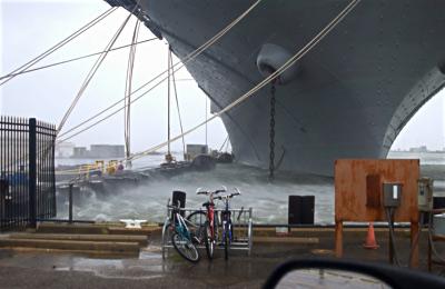
The IPP’s stated mission was that upon completion of the two year effort, Hampton Roads would have a path to establish a regional Whole of Government and Whole of Community organizational framework, along with recommended procedures to effectively coordinate sea level rise preparedness and resilience planning for the region. Further, the IPP’s vision and the National Security Council’s objective included the development of this regional framework for Hampton Roads as a template that could be used for other regions.
Best Practices: The IPP validated a number of successful practices that could transfer to any region addressing similar challenges.
- First and foremost — it started with an established Charter, Mission, and Vision statement. This helped guide committees and working groups throughout the process, and allowed them to continue their work at an independent pace.
- The IPP was fortunate to solicit whole of government and community involvement early in the process, including participation at the federal, state, and local level. This attribute was hailed as one of the key discriminators in overall value to participants, and to the success of the outcome.
- The use of a university as the convening authority also added merit to the process, serving as a trusted agent, facilitating work in a non-partisan environment, and with the ability to match and support research and curriculum with the project’s efforts and outcomes.
- The initial construction of the charter included proposed working group and committee membership, by organization or agency, expertise, and in some cases, by name. This created a much simpler path to establishing group membership for working group and committee chairs, and also added an additional level of focus and understanding of the anticipated level of experience.
- The IPP also established, as a part of its recommendations, a process to consider future outcomes and to recommend additional work — including studies, pilots, test projects, and suggested funding sources.
- The task of identifying funding sources to support the IPP’s activities proved the most challenging aspect of the effort from the start, and was called out as an item for resolution as early as possible in any similar process.
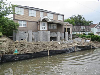
Desired Outcomes: The Pilot Project identified five key desired outcomes to help Hampton Roads move forward in adapting to this challenge, shown here as synthesized from case studies and findings across the committees and working groups, and including lessons learned from South Florida, New Orleans, and the Netherlands. They are as follows:
- Develop and implement common Regional Planning Standards — including, but not limited to common first floor elevation/building codes/GIS attributes/sea level planning scenarios — to facilitate effective regional planning and execution of adaptation efforts.
- Establish support from a Consortium of Universities — ensure the best possible science, data, and engineering expertise from a non-partisan trusted agent.
- Establish a Regional Data Center — ensure an independent, centralized ability to collect, analyze, distribute, and respond to regional data needs.
- Ensure collaborative, prioritized planning and execution — create formalized relationships between Federal/State/Cities/Municipalities/ Businesses/Non-profits and Citizens
- Identify funding strategies and create funding instruments for regional program needs — bring together and prioritize opportunities from multiple sources including federal, state, local government, private industry, and non-profits.
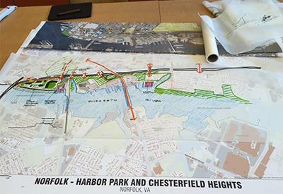 Next Steps: The Pilot Project identified the establishment of a regional planning and execution entity as a key factor to enable whole of government and community adaption efforts. Designation as a “special service district authority” or “the joint exercise of local government powers by agreement” would allow this regional entity to identify, facilitate, and prioritize those adaptation efforts based on identified regional needs that collaborative oversight and funding. As a recommended first series of actions, this entity could undertake a regional identification and evaluation of critical (as defined by the region) public and private infrastructure that are vulnerable to sea level rise. It could then prioritize impacted infrastructure needs, and evaluate region-wide dependencies and interdependencies of that infrastructure. Once regional vulnerabilities are understood, the next consideration could be to conduct a regional watershed vulnerability study and from that, develop a regional urban water plan.
Ongoing Work: While this regional planning and execution entity has yet to be created, there are tremendous ongoing individual efforts by cities and municipalities, including, but not limited to:
- Norfolk’s Vision 2100 Plan,
- Coastal Storm Risk Management Study (with USACE),
- National Disaster Resilience Competition Grant award for the ongoing Ohio Creek Watershed Transformation,
- Virginia Beach’s ongoing Comprehensive Sea Level Rise and Recurrent Flooding Analysis and Planning Study, and
- Hampton’s ongoing Coastal Resilience and Urban Water Planning efforts.
 More broadly across the region, the Hampton Roads Planning District Commission hosts a Coastal Resiliency Policy Advisory Committee and Working Group, and is overseeing Joint Land Use Studies evaluating Norfolk/Virginia Beach 2017–2018, with a Chesapeake-Portsmouth study planned to start later in 2018. These studies, funded by the Department of Defense Office of Economic Adjustment, will evaluate sea level and recurrent flooding impact on federal military infrastructure, and make recommendations for adaptation measures.
Other ongoing activities:
- The Commonwealth Center for Recurrent Flooding Resiliency (CCRFR), established in 2016, partners Old Dominion University (ODU) with William and Mary’s Virginia Coastal Policy Center and Virginia Institute of Marine Science to address statewide recurrent flooding challenges.
- ODU sponsors the Resilience Collaborative, a professorial consortium of subject matter experts, collaborating on sea level and climate impact research.
- Further, RISE Coastal Resilience Laboratory, established through the NDRC grant competition award, is focused on creating incentives for strategic regional resilience through accelerating innovation related to adaptation measures.
Finally, there are two ongoing studies that evolved from the IPP:
- The Department of Transportation working with Virginia Maritime Association, Port of Virginia, HRPDC, and ODU on a regional transportation Economic Impact Quantification Study, and
- Members of the Resiliency Collaborative, NDRC Grant Project Team, and the IPP teamed on a Cross Municipality Watershed Study with the cities of Chesapeake and Portsmouth.
While there are actions and activities underway across the region at every level, the need for the regional collaboration and oversight entity identified by the IPP grows as water levels continue to rise and the land subsides. The IPP showed the tremendous value of regional partnerships working in collaboration across the whole of government and community. Now, it is up to Hampton Roads to seize this opportunity to take the lead in developing collaborative adaptation and mitigation strategies and actions to address to this existential threat — and we have no time to lose!
To view the IPP final report and case studies on line, go to: ODU Digital Commons
About the author: Rear Admiral Ann C. Phillips, US Navy (Retired) chaired the Infrastructure Working Group for the Hampton Roads Intergovernmental Pilot Project from 2014–2016. She is now a member of the Advisory Board for the Center for Climate and Security. The opinions expressed are her own.


